|
Inis Cealtra [Iniscaltra] is an uninhabited 300m wide x 450m long island located in the south-west
region of Lough Derg, close to the village of Mountshannon in County Clare. The name Inis Cealtra
has been translated as the ‘island of churches’. The ruins of an ancient 6th/7th
century monastic
settlement founded by St. Colum, though it's mainly associated with St. Caimin who was abbot on
this island, include five churches, a round tower, a holy well, five bullaun stones, many beautiful
grave markers and slabs, remains of high crosses and a cillín.(Old Ordnance Survey maps mark it
as “Garaidh Mhichaeil” [Michael’s Garden] a burial ground for unbaptised children and also a place
where people, suffering from deadly diseases, were buried).
Today Inis Cealtra appears to be a remote island hermitage, but in the 6th/7th centuries it was
situated on one of the most important ancient highways of Ireland; the River Shannon. Being
positioned on such an important routeway meant easy access for pilgrims, the tourists of the day,
who brought wealth and status to the island monastery. The easy access was also a double-edged
sword, as it was also easy access for the Vikings, and the Annals record raids on the monastery
in 836 and 922 A.D. The Reformation did more damage than the Vikings and the churches of Inis Cealtra
were never re-roofed or reoccupied after the mid 1500s.
The island has been a place of pilgrimage for over 1,000 years and still is. Pilgrims do rounds among
its monuments which are used as stations.
|
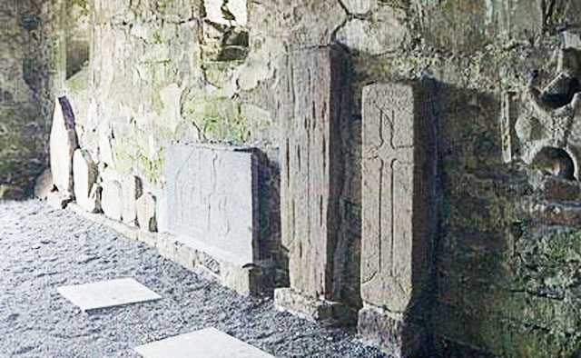 |
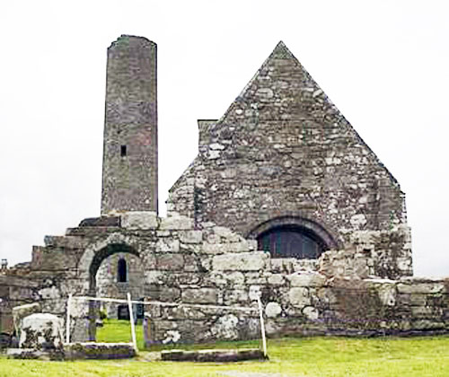
St.
Caimin’s Church (the only roofed building on the island) was
built at the beginning of the 10th century by Brian Boru, High
King of Ireland. Inside the nave are several grave slabs and
crosses from the 8th/12th centuries.
|
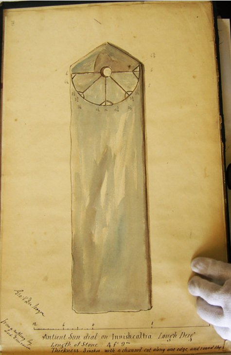 |
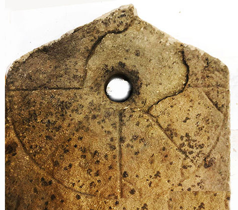
An ancient vertical stone
sundial,dated to the 7th
century was originally located in the cemetery. It was moved first to inside
St.Caimin's Church and then off the island to Office of Public Works storage in Athenry
where it remains. Length 1475mm, width 395mm, thickness
75mm, diameter of dial 375mm, Gnomom hole diameter 50mm,
On the left is a copy of a drawing by the
Geologist/Antiquarian/Artist George V.Du Noyer circa 1860.
In addition to the scale and
detailed dimensions, notes on the drawing read
"Ancient Sun dial on Innishcealtra Lough Derg.
Length of Stone 4ft 9"
Thickness 3" with a channel cut along one edge and round the top. |
|
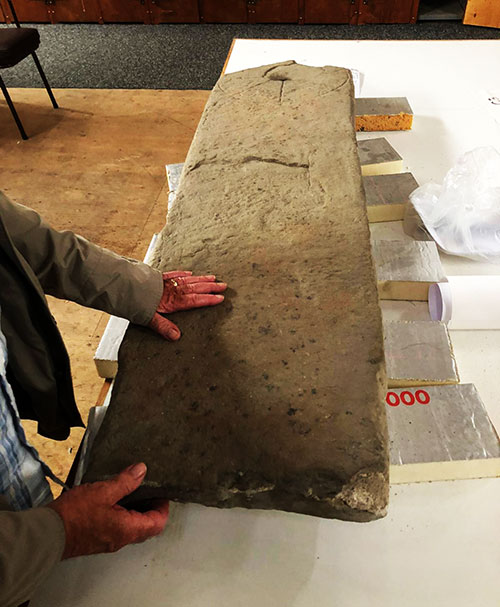
The dial from Inis Cealtra now in
the OPW Athenry store. Photo left shows the flaking of the
surface and around the gnomon hole
recorded by Du Noyer 160 years ago. |
|
The dial face
has been damaged by a large flake breaking off around the gnomon hole. |
|
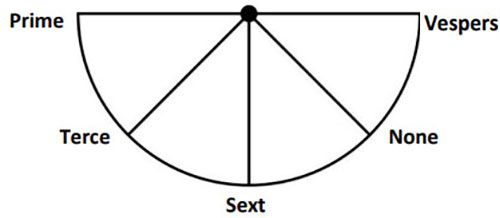
The temporal lines on these
Ancient Monastic sundials
were designed not to measure the passing hours but to mark the times
when canonical prayers should be said
viz Dawn(Prime), Mid-morning(Terce), Mid-day(Sext), Mid-afternoon(None)
and Evening(Vespers).
|
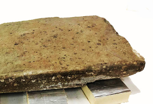 |
The end of the sundial
shaft (see opposite),had been tapered both sides and undercut at
the back so as to fit into a socketed stone in much the same way as the
High Crosses were |